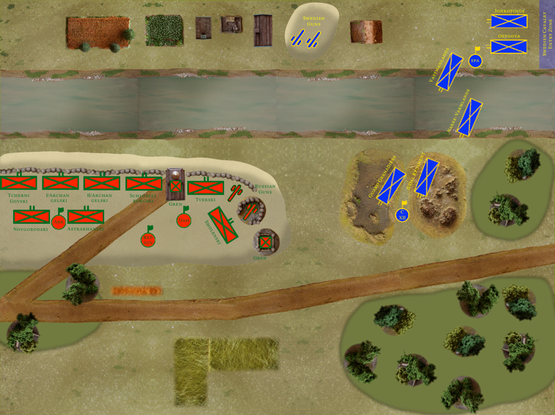
Here’s the final map for the deployment of the Holowczyn scenario:

Main differences with the previous one are reworked hills (thanks Alan), blended-in terrain and — obviously — the Swedish and Russian units at deployment.
They’re all high resolution PNG images (the background for them is transparent), scaled and layered over the drawn bits of the image. I use Pixelmator, which is indeed a Photoshop-like image manipulation program for the Mac. Remind me next time we meet and I’ll burn them on a CD or put them on a USB stick (they’re several megabytes each).